
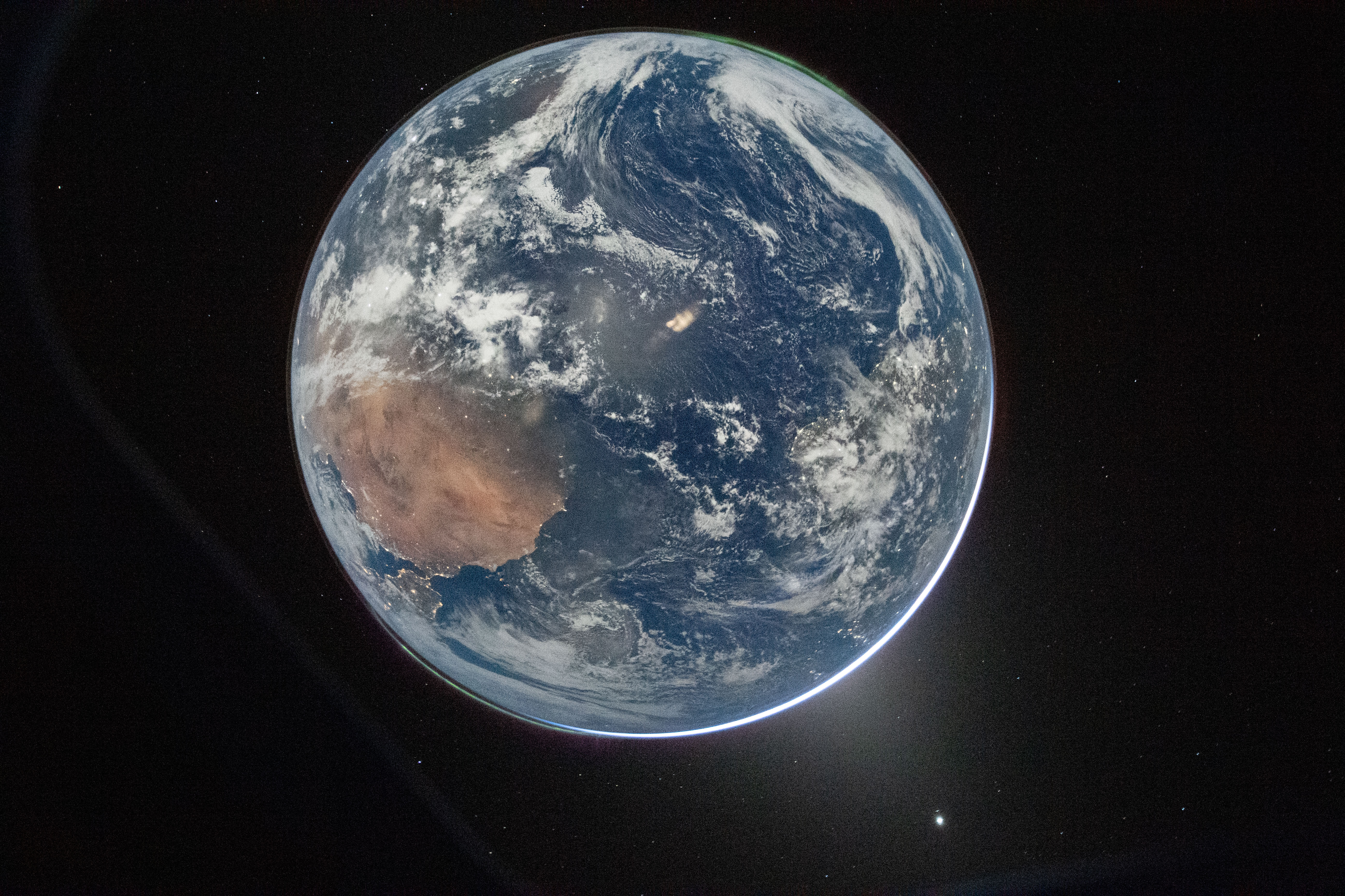
Your comment history suggests you're in the US, so you should be pleased to learn that you weren't included. The visible landmass is northern Africa, with a smidge of the Iberian Peninsula visible.
replySouth America is visible on the right, and it looks to me like part of North America might also be pictured close to the horizon.
replyHigher-resolution image: https://www.nasa.gov/wp-content/uploads/2026/04/art002e00019...
Oh, good point. I missed South America under the cloud cover. I guess the Eastern edge of the US would indeed be visible as a highly distorted smudge on the edge of the visible surface.
replyFor a view of roughly the same half of Earth, but with less clouds, if you rotate the image clockwise by 150 degrees you get roughly this viewpoint of the earth: https://earth.google.com/web/@3.63731074,-23.1618975,-2690.7...
Thanks!
replyThere's a heading control to include rotation in link: https://earth.google.com/web/@3.63731074,-23.1618975,-2690.7...
Thank you. I have having trouble making sense of the orientation. My first thought was misshapen Australia, but where Spain nears Africa is much different than Australia and Tasmania. Also, they forgot New Zealand... while common for maps, I would expect it to show up in a photo.
replyIf they somehow manage to get another photo which features Australia without New Zealand that would be the best Apr 1st joke I've ever seen
replyThanks I was looking for an orientation comment.
replyClassic American thinking even from space they are the center of the world smdh
replyglad you accept that fact
replyTell the world you're REALLY fat without telling the world ...
reply"Your mom is so fat she would take a whole pixel on that image"?
replydeleted
replydeleted
replyBad news, I was across town and I do consent to my pixel being used, so you're outta luck
reply