
Does the PWA state of things resolve that in the modern days? If it did, yeah I'd agree, no need for an app at all. In my case the app was being used in rural Ontario. I cant even make a phone call here without wifi.
Gosh, I wish more apps did some kind of progressive "enhancement" and let people read already cached messages and do deferred sends like the old days, instead of being completely useless without a data connection.
I spent many late nights trying to debug reachability bugs. It's frankly a nightmare trying to build a reliable app when the user has /some/ cell service, but not enough to operate the app reliably.
(And so, so many little bugs in my map thing from upthread were these odd timing quirks when a user didn't have good service and one check would run and leave something else hanging resulting in a blank map. <sigh>)
Home depots website sucks anyway, slow, clunky, terrible touch space, and the search is awful.
Aside, they should ad cell repeaters inside to fix all this.
Each map is 16MB - 20MB in total, so this is all nice and simple to do. Even on a slow 3G connection it's only a minute or so for a full map update to stream in.
The whole point of this system was to take a snapshot of data (mostly OSM), add on some local things that can't really be represented in OSM (like WHICH parking lots are most appropriate, stylistic overrides, system descriptions, etc) and display them. Because of issues I've had in the past with well-meaning-but-misguided OSM mappers wrongly editing trail systems I did not want anything that pulls live.
And then by having purely static content the hosting is very cheap and easy, there's no security concerns around... well... anything dynamic on the site. And each map is portable were I to want someone else to host them. And literally in a couple of years if I haven't updated the map it won't change yet still will work, and that's fine and accepted for this use. Sort-of like a mobile version of a traditional print map. Kinda like the print workflow of editing/design/etc and then rendering the PDF, but web.
This all aligned nicely for me to have a tool that works this way, with each map generated by a tool.
(Sort-of disclaimer: It was also a big personal project in learning to work with AI stuff for development. I knew and understood the inputs and outputs, was able to design the UI, handled/managed all the testing... But I didn't have to worry about the actual-code part. I was able to make pretty quick progress and iterate nicely on my ideas.)
Happy to talk, etc, more about it too. Either here, or contact info is on the site.
Also, apparently Apple really doesn't like approving apps that are basically wrapped PWAs (Google will, I guess?) so that is yet another check against bothering with an app.
The main idea was to solve the gap of how many trail systems have colored loops, or signed/colored loops made up of multiple "trails", and Trailforks (et al) has no concept of that. So the situation a user finds themselves in is being at a trail, with Trailforks up, wanting to follow the "Orange" loop (for example), and Trailforks doesn't show that.
Hopefully the "Orange" loop is documented as a route, but this stuff often gets missed, and is still awkward since the image of the map still doesn't match the signs.
So my goal was to show the map close to what's physically there, use OSM data as much as possible, and filling in gaps for what OSM doesn't capture, rendering it all into a static map that also happens to work offline. For some specific examples, compare these two systems and their print, Trailforks, and trailmaps.app maps:
RAMBA: [1], [2], [3] Shelden Trails: [4], [5], [6]
There is the same kind of gap when compared to RideWithGPS, Strava, Gaia, etc.
And also, I'm a volunteer with our local trails non-profit. I want anyone and everyone to be able to find maps so they can enjoy the trails. A /lot/ of trail clubs are starting to replace maps with a link to Trailforks, which I believe does riders a disservice because it both requires an app and account and (if a user is trying to view a map out of their home area on a phone) payment. It's literally locking the basic info about a trail -- the map -- behind a semi-paywall. By making a system like this for our local trails I've helped completely avoid that mess. And so I made the map generator open as well so other techy folks can do the same or build on this.
This generated-static-map system does have the downside of being single-person-ish manually managed, and the maps do NOT update automatically. But I also see this as a feature, just like the print maps and in-person signage they are designed to complement.
I've prattled on a little more about the what-why-etc over here on my personal blog if you're interested: https://nuxx.net/blog/2026/06/25/trailmaps-app-map-generator...
--
[1]https://static.wixstatic.com/media/9d19d2_b85c5684f54a4fdc85...
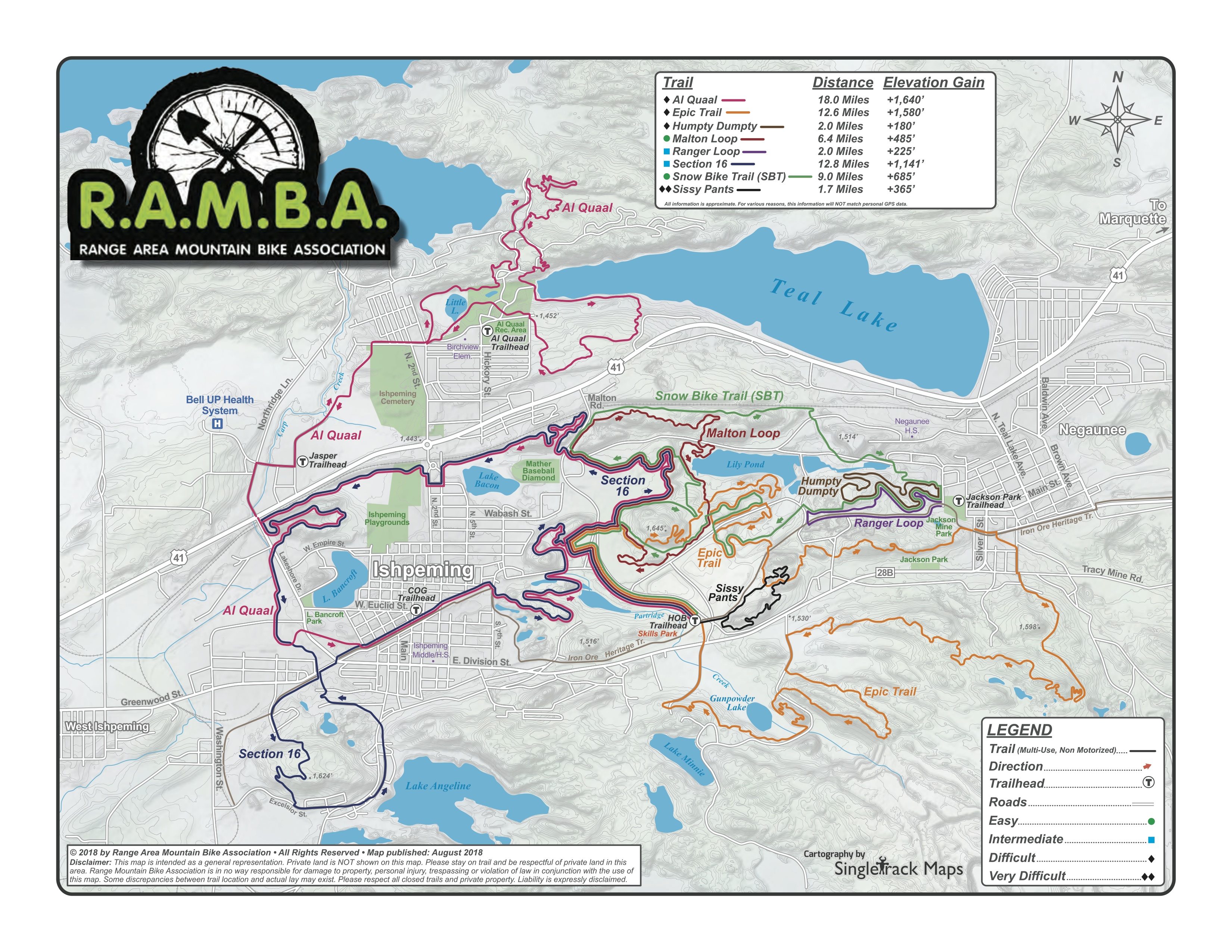
[2] https://www.trailforks.com/region/ramba-trails/
[3] https://trailmaps.app/ramba/
[4] https://www.metroparks.com/wp-content/uploads/2022/04/2022-S...
[5] https://www.trailforks.com/region/stony-creek-metropark/
Our local trail association did that. Well, actually we went from an old “become a member to download GPS files” to “go find the trails on Trailforks”
But that was when Trailforks was more open and less locked down.
We’ve discussed replacing Trailforks with something better/more under our control, but haven’t gotten around to it.